Vantor Launches WorldView 3D for High-Cadence Global Mapping
Vantor—formerly Maxar Intelligence—has introduced WorldView 3D, a mapping suite offering resolutions up to 15 centimeters and rapid 24-hour turnaround for satellite-derived terrain models.
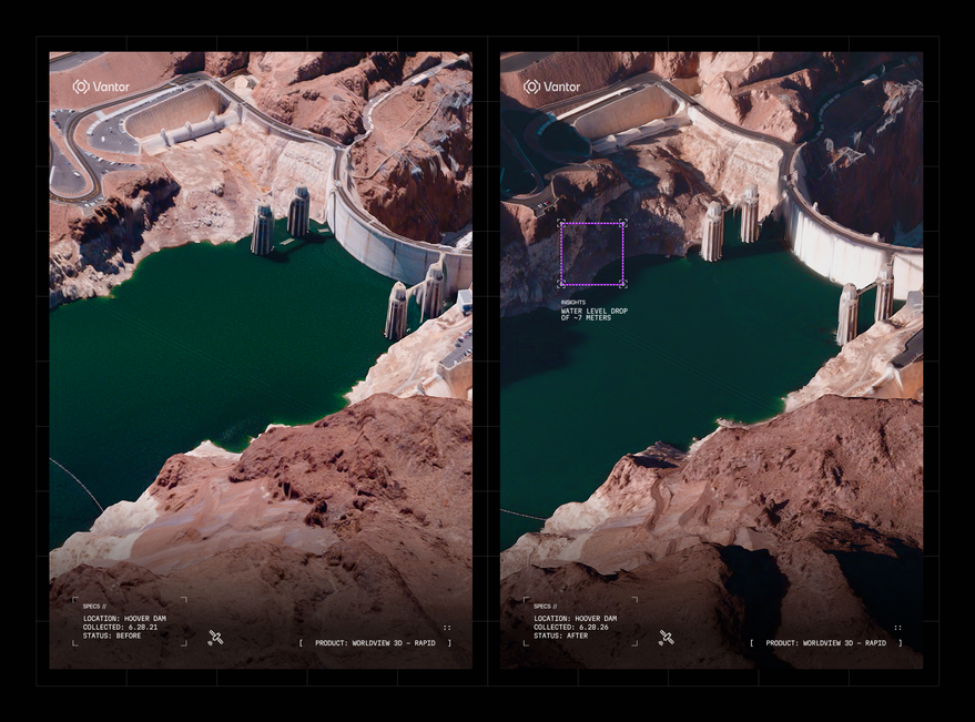
DATA OVERVIEW: 3D TERRAIN RECONSTRUCTION
Vantor, the entity formerly known as Maxar Intelligence, has activated WorldView 3D, a new product line designed to deliver high-definition, updated spatial data. According to SpaceNews, the suite leverages Vantor's proprietary reconstruction algorithms to convert satellite imagery into actionable 3D environments at unprecedented speeds.
TECHNICAL SPECIFICATIONS
The product line is bifurcated into two specific service tiers:
WorldView 3D Rapid: Capable of delivering 50-centimeter resolution maps within a 24-hour window from tasking. It offers a 4-meter vertical accuracy, geared toward tactical operators and disaster response teams.
WorldView 3D High Definition (HD): Designed to compete with traditional aerial mapping, this tier delivers 15-centimeter resolution with 3-meter accuracy, utilizing Vantor’s extensive satellite archive.
ARCHITECTURAL INTEGRATION
The initiative is fueled by Vantor’s constellation of six WorldView Legion satellites launched over the past two years. By integrating tech inherited from the 2020 acquisition of Vricon, Vantor now processes data from single satellite passes to update 100 million square kilometers of terrain.
Peter Wilczynski, Vantor’s Chief Product Officer, stated that the move addresses a critical gap in machine learning. As AI models and robotics workflows expand, they require grounding in high-fidelity, three-dimensional spatial data rather than flat imagery. Beyond pure mapping, the system powers Raptor, a terrain-based positioning tool intended for drones operating in GPS-denied environments.