Subglacial Mapping Reveals Greenland’s Hidden Topography
Utilizing airborne radar and satellite data, NASA has mapped a vast network of subglacial valleys beneath the Greenland Ice Sheet, providing critical data for sea-level rise projections.
Sub-Ice Reconnaissance
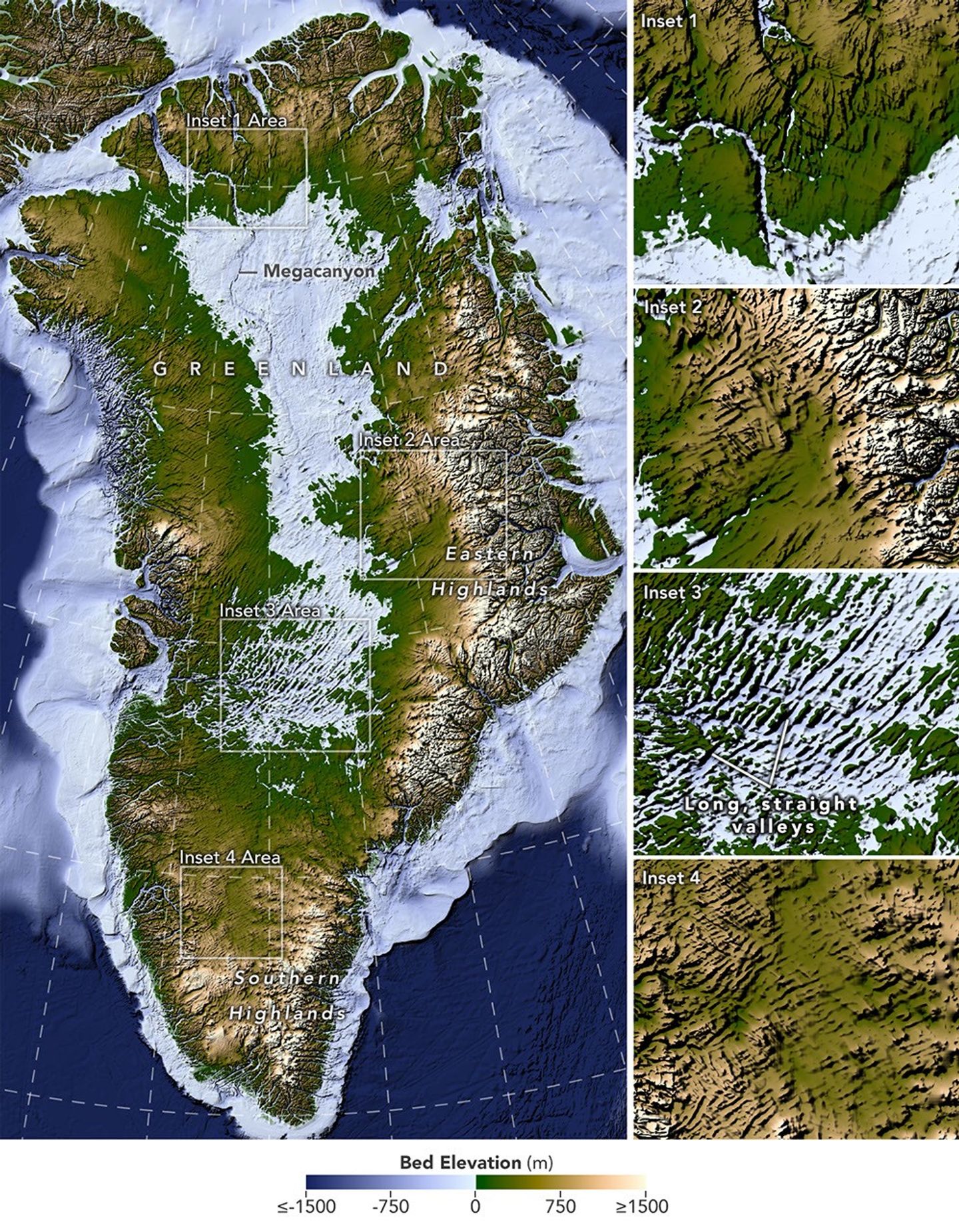
Data gathered from decades of airborne radar surveys and satellite missions has allowed researchers to peer through kilometers of ice to resolve the terrestrial landscape of Greenland. According to NASA Breaking News, these sophisticated mapping efforts have exposed a complex network of canyons and valleys that have remained obscured by the Greenland Ice Sheet for millennia.
The Bedmachine Project
Central to this discovery is the integration of multi-source datasets, including NASA’s Operation IceBridge. By deploying ice-penetrating radar, scientists can calculate the precise thickness of the ice and the contours of the bedrock below. This process, often referred to as 'BedMachine' mapping, uses the physics of ice flow to interpolate the terrain between radar tracks, providing a high-resolution view of the island’s subglacial architecture.
Implications for Glaciology
The findings are not merely geographical. The shape of the bedrock dictates how ice moves from the interior to the coast. The newly identified valleys act as conduits; deep, steep-walled troughs can accelerate the flow of glaciers toward the sea, especially as warming oceans interact with the ice at the grounding lines. Understanding this 'hidden' plumbing is vital for refining climate models.
System Update
As the Arctic continues to undergo rapid thermal transition, the data provided by these orbital and aerial assets remains the primary diagnostic tool for assessing global sea-level stability. The mapping reveals that some valleys are deeper than previously estimated, suggesting that the ice sheet may be more vulnerable to ocean-driven melting than earlier models predicted.