Orbital Watch: Typhoon Surigae Data Profile
High-resolution satellite imagery captured by the European Space Agency reveals the structural intensity of Typhoon Surigae as it tracks across the Pacific.
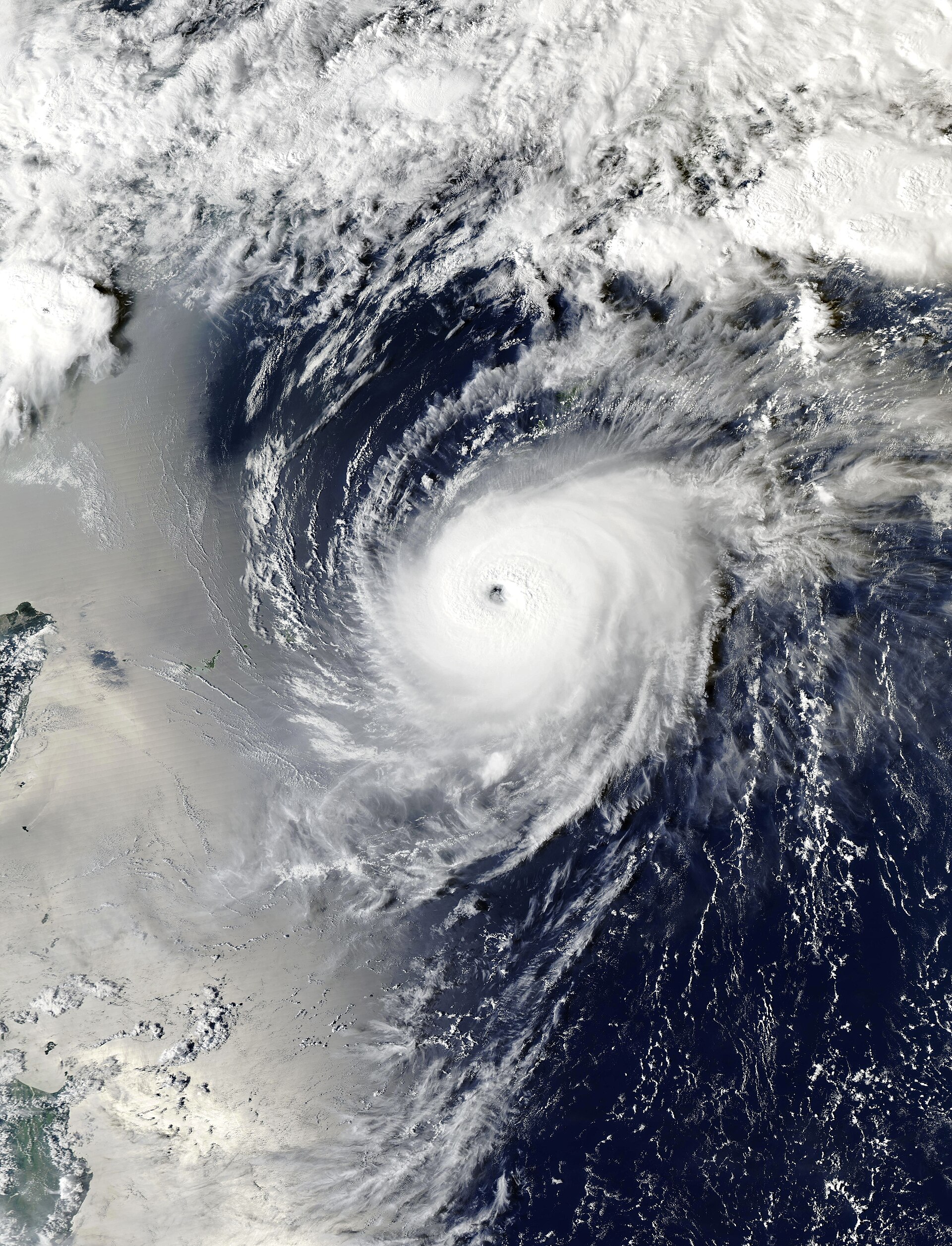
Data Acquisition: Typhoon Surigae
Atmospheric monitoring systems have logged high-resolution visual data of Typhoon Surigae as it transverses the Pacific theater. According to the European Space Agency (ESA), satellite assets have captured the storm’s structural evolution, providing critical telemetry on cloud-top temperatures and wind-field dynamics.
Surigae represents a significant meteorological event, demonstrating intense convection patterns visible from low-Earth orbit. The imagery released by ESA displays the storm’s defined eye—a characteristic of high-intensity tropical cyclones—surrounded by dense, rotating wall clouds. These observations are not merely aesthetic; they are vital for the refinement of predictive climate models and disaster mitigation protocols.
Operational Context
ESA’s Earth Observation programs continue to serve as the primary gateway for European orbital capabilities. By utilizing a constellation of sensors, the agency ensures that investment in space infrastructure delivers actionable intelligence to global citizens. This data stream is essential for tracking the trajectory of such super-storms, which pose direct risks to maritime operations and coastal infrastructure in the Asia-Pacific region.
As part of its mission to shape Europe’s space development, ESA maintains a rigorous schedule of atmospheric surveillance. The analysis of Surigae aligns with the agency’s broader objectives: ensuring European resilience through sovereign orbital technology and providing high-fidelity environmental data to the international scientific community.