Orbital Watch: Peatland Fire Event in Indonesia
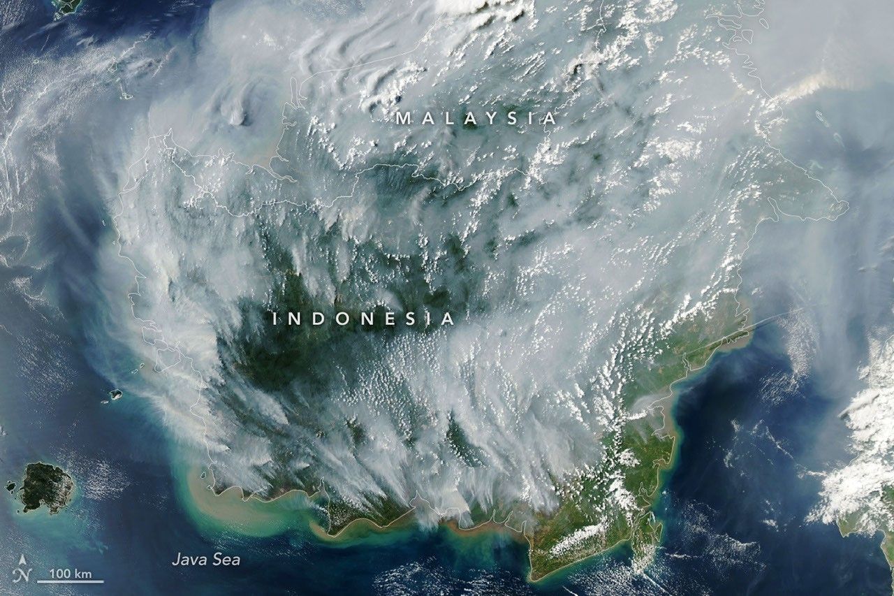
Satellite imagery from NASA’s Aqua mission confirms widespread peatland fires across Indonesia, leading to severe atmospheric haze and significant carbon release into the biosphere.
Data Feed: Aqua Mission
Orbital sensors have detected a significant thermal event occurring across the Indonesian archipelago. According to NASA Breaking News, the Aqua satellite—a multi-national Earth-observing research platform—has captured high-resolution imagery of dense smoke plumes originating from extensive peatland fires. This atmospheric disturbance has effectively darkened regional skies, impacting both local air quality and the broader planetary carbon cycle.
Environmental Impact Analysis
The fires are concentrated in the carbon-rich peatlands of Sumatra and Kalimantan. Unlike surface vegetation fires, peat fires burn through deep layers of organic matter, often smoldering underground for extended durations. This process releases massive quantities of carbon dioxide and methane, gases that are critical factors in the Earth's warming trends. The Moderate Resolution Imaging Spectroradiometer (MODIS) instrument aboard the Aqua satellite identified these heat signatures, confirming the scale of the combustion.
Atmospheric Observations
The resulting haze has reached hazardous levels, obstructing visibility and posing severe health risks to the regional population. NASA's Earth-observing fleet remains the primary source for tracking the movement of these aerosols across the Pacific. The data collected serves as a vital indicator for climate scientists monitoring the feedback loops between land-use changes and global temperature rises. As of the latest downlink, the thermal anomalies remain active, with smoke drift persisting across Southeast Asian shipping lanes.