Orbital Forensics: Tracking the Disappearance of Lake Aculeo
Satellite data provides a chronological autopsy of Lake Aculeo’s total dehydration, serving as a critical indicator of climate-driven water scarcity.
Terminal Feed: Environmental Monitoring
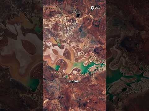
Data acquisition from Earth Observation (EO) satellites has confirmed the complete desiccation of Lake Aculeo in central Chile. Once a significant body of water near Santiago, the lake has transitioned from a vibrant ecosystem to a barren basin, a process meticulously documented by orbital sensors. According to ESA YouTube, this event serves as a stark visualization of the compounding effects of sustained drought and anthropogenic water mismanagement.
//The Data Profile
The decline was not instantaneous but a steady degradation visible across the electromagnetic spectrum. Multi-spectral imaging allows researchers to track the receding shoreline and the subsequent loss of surrounding vegetation. The primary drivers identified include a decade-long 'mega-drought'—the longest in the region's recorded history—and the diversion of inflow for agricultural and domestic consumption. The disappearance of the lake signifies a terminal state for the local microclimate, as the thermal regulation provided by the water body has ceased.
//Strategic Implications
For the scientific community, the Aculeo case study is a calibration point for predictive models. By analyzing the temporal resolution of these satellite images, analysts can identify early warning signatures in other at-risk basins. The role of space-based assets is no longer just observational; it is forensic. As global temperatures rise, the ability to monitor hydro-geological changes from orbit becomes the primary method for assessing resource security and ecosystem collapse in real-time.