ORBITAL FEED: GUINEA-BISSAU TIDAL DYNAMICS CAPTURED
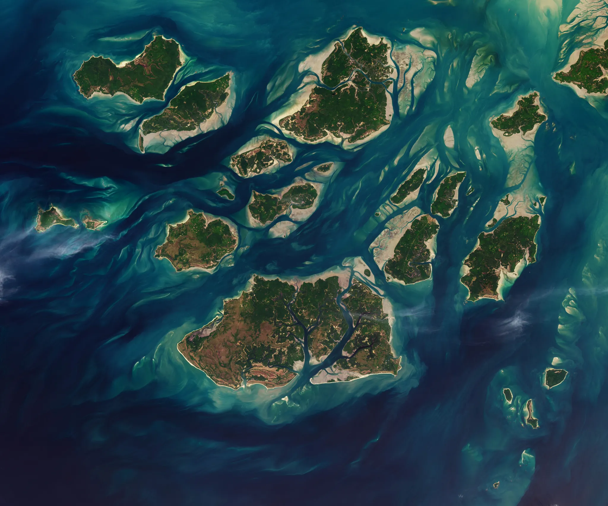
Satellite monitoring systems have logged high-resolution imagery of the Guinea-Bissau coast, highlighting the complex interaction between the Atlantic Ocean and West African river systems.
GEO-DATA ACQUISITION
Earth observation platforms have registered a significant visual dataset of the Guinea-Bissau coastline, focusing on the intricate tidal networks where the Geba and Corubal rivers meet the Atlantic. According to NASA Breaking News, these orbital perspectives provide critical data on sediment transport and hydraulic movement within one of West Africa's most complex estuarine environments.
ANALYTICAL OBSERVATIONS
The telemetry reveals a highly fragmented archipelago—the Bijagós Islands—buffeted by intense tidal currents. The interaction between freshwater discharge and oceanic inflow creates a distinct thermal and sedimentological signature visible from Low Earth Orbit (LEO). This region acts as a natural laboratory for studying mangrove ecosystem resilience and coastal erosion under the pressure of fluctuating sea levels.
STRATEGIC CONTEXT
Tracking these tidal waters is essential for climate modeling. By monitoring the siltation patterns and the reach of saline intrusion, researchers can better predict the long-term viability of the region's biodiversity. While NASA maintains the primary data feed, the implications for global maritime logistics and environmental monitoring are significant for all space-faring nations. The precision of current imaging technology ensures that even the smallest shifts in these coastal veining systems are logged for longitudinal study.