Orbital Analysis: The Venetian Lagoon Observed
New Sentinel-2 data captures the delicate ecological and infrastructural balance of the Venetian Lagoon, highlighting ESA's continuous monitoring of critical European coastlines.
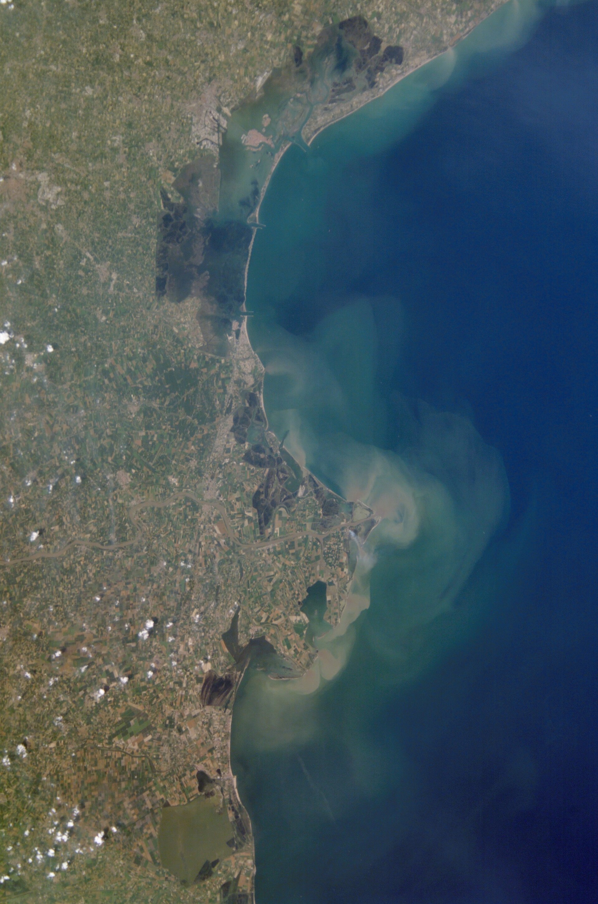
DATA OVERVIEW: LAGOON MORPHOLOGY
High-resolution imagery acquired from Earth orbit provides a definitive perspective on the Venetian Lagoon, an enclosed bay in the Adriatic Sea that sustains one of the world's most vulnerable heritage sites. According to ESA, the monitoring of this region is critical for assessing the long-term impact of rising sea levels and the efficacy of local coastal defenses.
GEOLOGICAL COMPOSITION
The Venetian Lagoon spans approximately 550 square kilometers, though only 8% is composed of land—including the historic center of Venice and numerous smaller islands. The remainder of the basin consists of mudflats, tidal shallows, and salt marshes. The imagery clearly delineates the three primary inlets—Lido, Malamocco, and Chioggia—that facilitate water exchange between the lagoon and the Adriatic Sea.
INFRASTRUCTURAL INTEGRATION
Visible in the data are the artificial structures of the MOSE project, a series of integrated mobile barriers designed to protect the city from exceptional high tides (Acqua Alta). By utilizing the Copernicus Sentinel-2 mission, ESA provides multispectral data that allows researchers to differentiate between sediment concentrations, water depths, and vegetation health across the marshlands.
TERMINAL SUMMARY
Continuous orbital surveillance remains the primary method for tracking the morphological evolution of this fragile ecosystem. The ability to monitor these shifts in near-real-time ensures that European environmental agencies can adapt to the accelerating challenges of Mediterranean climate shifts. Data integrity remains high, providing a baseline for future hydraulic modeling and urban preservation efforts.