Orbital Analysis: The Saskatchewan River Delta Agricultural Anomalies
High-resolution satellite imaging reveals the stark contrast of the Carrot River Triangle, a 150,000-acre agricultural enclave thriving within North America's largest inland delta.
# Saskatchewan Delta: An Orbital Perspective
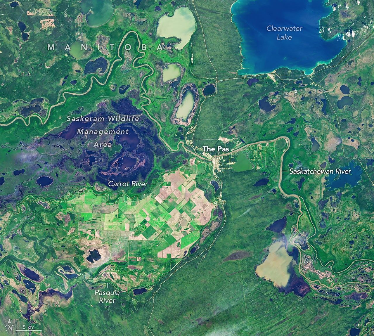
Sensor arrays from NASA’s Earth Observatory have captured high-fidelity imagery of the Saskatchewan River Delta, highlighting a significant geomorphological and economic anomaly known as the "Carrot River Triangle." According to NASA Breaking News, this region represents a massive agricultural “island” embedded within a complex network of wetlands, marshes, and boreal forest.
The Carrot River Triangle
Located at the intersection of the Carrot and Saskatchewan Rivers, this 150,000-acre (60,700-hectare) landmass stands in sharp contrast to the surrounding terrain. While the Saskatchewan River Delta spans roughly 1 million hectares—making it the largest inland delta in North America—it remains primarily a wilderness of peatlands and shallow lakes. The Triangle, however, has been engineered into a productive grain-producing hub.
Geospatial Contrast
Thermal and optical data reveal a distinctive geometric pattern of rectangular fields, creating a stark visual boundary against the organic, irregular contours of the delta’s natural wetlands. This agricultural zone benefits from the nutrient-rich alluvial soils deposited by millennia of river action, despite the high water tables that characterize the region. The area supports various crops, primarily wheat, canola, and barley, providing a critical economic output for the Canadian interior.
Environmental Stasis
Beyond the perimeter of the Triangle, the delta remains a vital ecological carbon sink. The preservation of the surrounding 940,000 hectares is crucial for regional biodiversity and flood mitigation. For orbital analysts, the Saskatchewan River Delta serves as a premier case study in the human modification of natural alluvial systems and the persistence of terrestrial agriculture in high-latitude environments.