Orbital Analysis: The Hydrodynamics of the Elbe Estuary
Satellite imaging provides a high-resolution look at the complex tidal exchange where Germany's Elbe River meets the North Sea, revealing the scale of sediment transport and hydrological shifts.
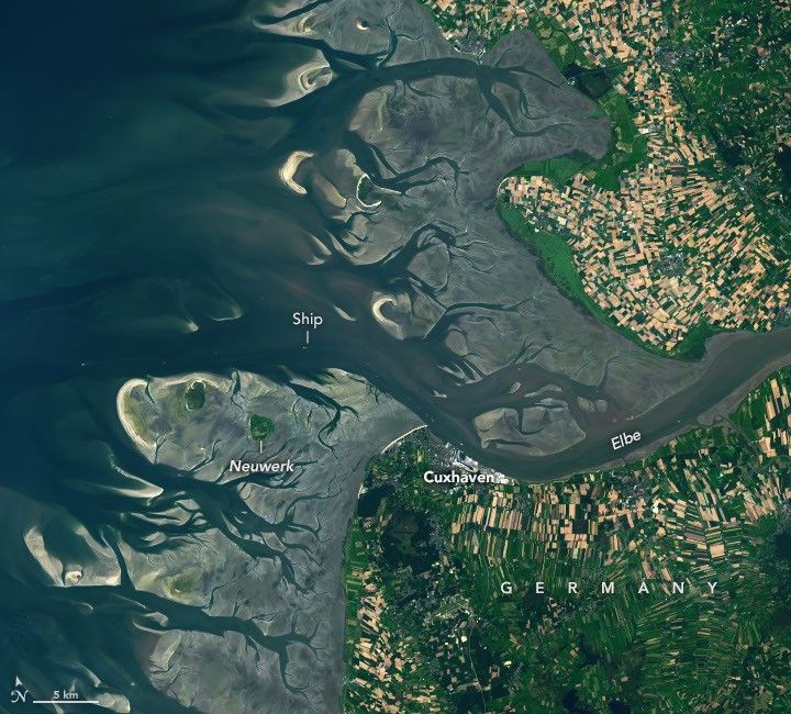
DATA OVERVIEW: THE ELBE INTERFACE
According to NASA Breaking News, orbital observations have captured the intricate tidal dynamics at the mouth of the Elbe River, a critical maritime artery in Northern Germany. The river, extending 1,094 kilometers from the Czech Republic through Hamburg, discharges into the North Sea, creating a highly volatile hydrological zone.
TIDAL MECHANICS AND SEDIMENTATION
High-resolution imagery reveals the massive scale of the Wadden Sea’s tidal flats. These areas, characterized by their rhythmic exposure and submergence, function as a biological and geological buffer. The interplay between freshwater outflow and saline North Sea influx creates distinct turbidity plumes. These sediment-heavy currents are visible from orbit, tracing the underwater topography of the estuary. The movement of this material is constant, shifting sandbanks and altering navigation channels that serve the Port of Hamburg, one of Europe's largest shipping hubs.
ENVIRONMENTAL AND MARITIME IMPACT
The Elbe’s estuary is more than a commercial transit point; it is a primary site for monitoring environmental shifts. The transition from high to low tide radically alters the landscape within hours, exposing vast mudflats that serve as a biosphere for migratory species. From an orbital perspective, the data underscores the fragility of these coastal zones against rising sea levels and intensifying storm surges. For the European space sector, these observations provide the empirical baseline required for precision maritime logistics and coastal preservation strategies. Remote sensing remains the only viable method to track these large-scale fluid transitions in real-time.