Orbital Analysis: The Geographic Evolution of Seattle
A high-altitude perspective on the Pacific Northwest reveals how geological forces and urban expansion have transformed Seattle's unique landscape.
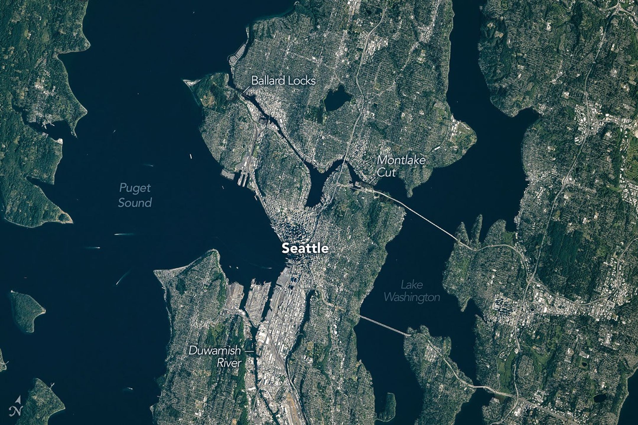
DATA OVERVIEW: SEATTLE TERRAIN PROFILE
Recent high-resolution imaging and analysis from the NASA Earth Observatory provide a stark visualization of Seattle’s highly localized geography. Known as the "Emerald City" due to its persistent evergreen cover, the metropolis is characterized by a topography defined by glacial retreat and tectonic activity. According to NASA Breaking News, the city’s current footprint is the result of thousands of years of environmental carving, followed by rapid 20th-century industrial re-engineering.
GEOLOGICAL LOGISTICS
Seattle occupies a narrow isthmus situated between Puget Sound—an inlet of the Pacific Ocean—to the west and Lake Washington to the east. This structural bottleneck has forced a vertical and dense urban expansion. Satellite telemetry identifies the significant ridges and valleys formed by the Vashon Glaciating, which retreated approximately 11,000 years ago. This ice sheet, 1,000 meters thick, shaped the primary north-south orientation of the city's landforms.
ANTHROPOGENIC MODIFICATION
Beyond natural forces, data highlights human-led "regrading" projects. In the early 1900s, engineers leveled entire hills (notably Denny Hill) to facilitate transportation. This orbital perspective confirms that the Emerald City is not just a biological phenomenon but a testament to aggressive structural modification. The interplay of water and land remains the city's defining logistical constraint, dictating the flow of human commerce via massive ferry networks and bridge infrastructure.