Orbital Analysis: The Congaree Forested Floodplains
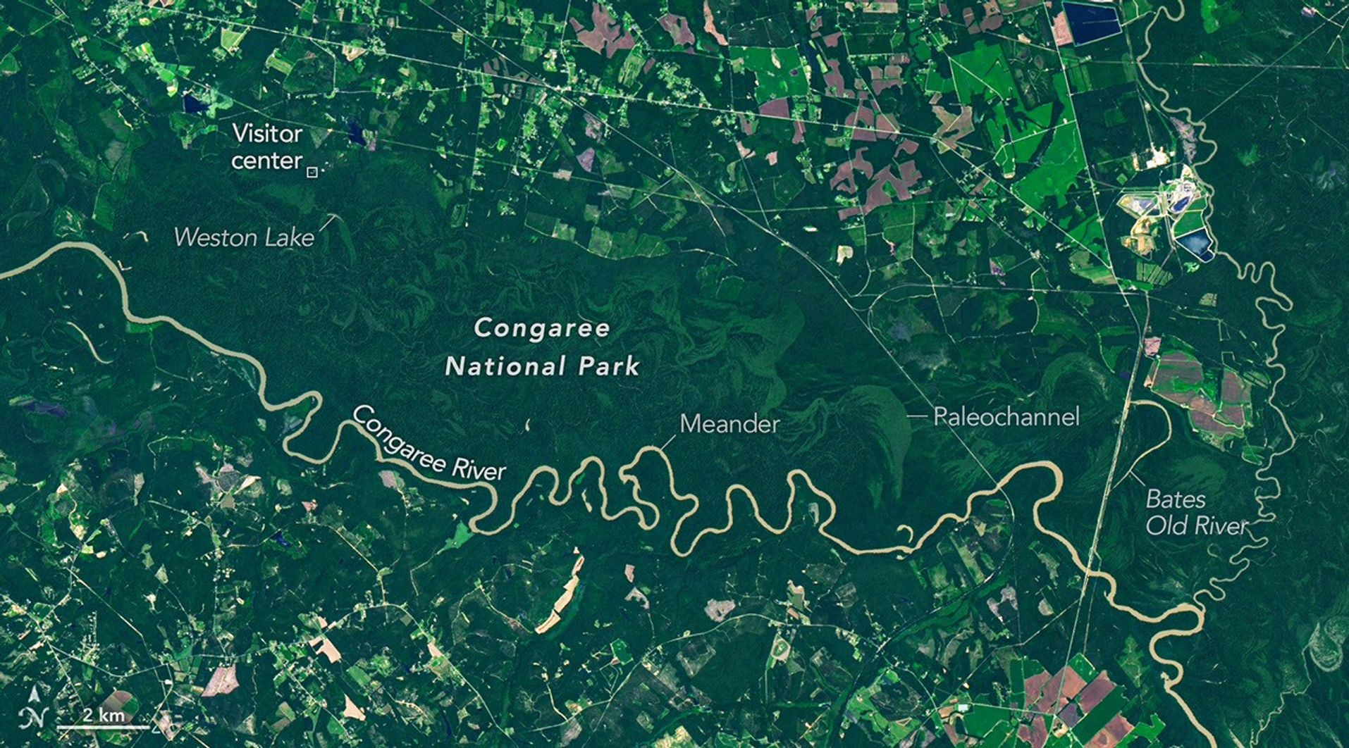
Satellite data reveals the unique hydrological architecture of South Carolina’s Congaree National Park, home to the largest intact old-growth bottomland hardwood forest in the southeastern United States.
Data Analysis: Hydrological Architecture
Remote sensing observation platforms have identified the Congaree National Park as a critical terrestrial node for biodiversity. Located in South Carolina, this region contains the most extensive remaining tract of old-growth bottomland hardwood forest in the southeastern United States. According to NASA Breaking News, the site serves as a primary example of a forested floodplain—an ecosystem defined by its cyclical interaction with adjacent river systems.
System Dynamics
The Congaree and Wateree Rivers periodically breach their banks, inundating the forest floor. This natural process facilitates a massive nutrient exchange, depositing nutrient-rich sediment that sustains the park's champion trees. These arboreal specimens reach heights exceeding 50 meters, creating a dense canopy visible from low-Earth orbit. This vertical complexity provides a unique habitat for avian and mammalian species that are otherwise rare in the Atlantic coastal plain.
Conservation Monitoring
Space-based monitoring is essential for tracking the health of this floodplain. As climate patterns shift, satellite telemetry allows researchers to observe how changes in precipitation and river flow impact the structural integrity of the old-growth timber. The park serves as a natural laboratory for studying carbon sequestration and flood mitigation. Unlike managed timberlands, the Congaree’s undisturbed state provides a baseline for understanding how temperate forests respond to large-scale hydrological events. This data is vital for global ecological modeling and terrestrial resource management.