Orbital Analysis: Heavy Rains Trigger Severe Inundation Across Thailand
Satellite monitoring confirms massive flood zones across Thailand following relentless seasonal rainfall, impacting agricultural sectors and urban infrastructure.
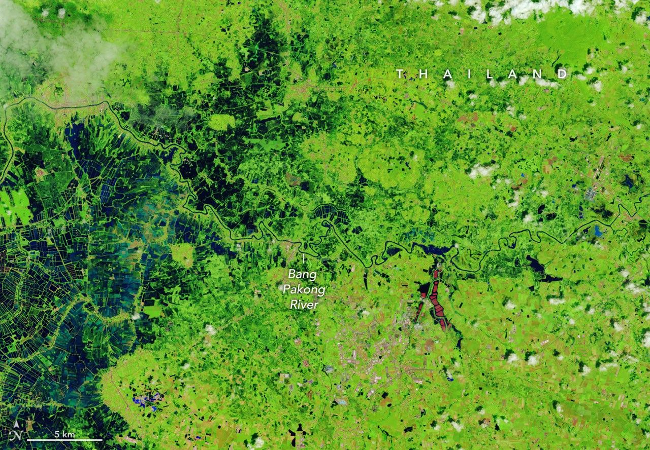
DATA OVERVIEW: THAILAND FLOOD EVENT
Satellite-based monitoring systems have confirmed significant flooding across vast regions of Thailand. According to NASA Breaking News, relentless seasonal precipitation has overwhelmed local drainage infrastructure and natural waterways, leading to widespread inundation that is clearly visible from low-Earth orbit.
GEO-ANALYSIS
Imagery processed through NASA’s Earth Observatory reveals the sheer scale of the saturation. The monsoon season—typically a period of high hydrological activity—has exceeded standard metrics this year, causing rivers to breach their banks and spill into the surrounding basins. The data highlights significant impact zones in both agricultural heartlands and urban peripheries. Low-lying terrain remains particularly vulnerable, with standing water disrupting transit corridors and logistics networks.
ENVIRONMENTAL IMPACT
Beyond immediate infrastructure damage, the floodwaters pose a severe threat to regional food security. Submerged rice paddies and damaged crops are visible in high-resolution multispectral scans. Local authorities are utilizing these orbital datasets to coordinate emergency response efforts and predict secondary surge zones as water moves downstream toward the Gulf of Thailand.
TERMINAL NOTE
Atmospheric monitoring indicates that while seasonal rains are expected, the intensity of this cycle aligns with shifting global climatic patterns. Space-based assets continue to be the primary diagnostic tool for assessing the full scope of the disaster, providing real-time telemetry for ground-based recovery units.