Orbital Analysis: Cottonwood Fire Scarring Utah Sector
Satellite reconnaissance reveals the extent of the Cottonwood Fire in Utah, providing critical data on post-ignition landscape degradation and thermal signatures.
Data Acquisition: Orbital Thermal Monitoring
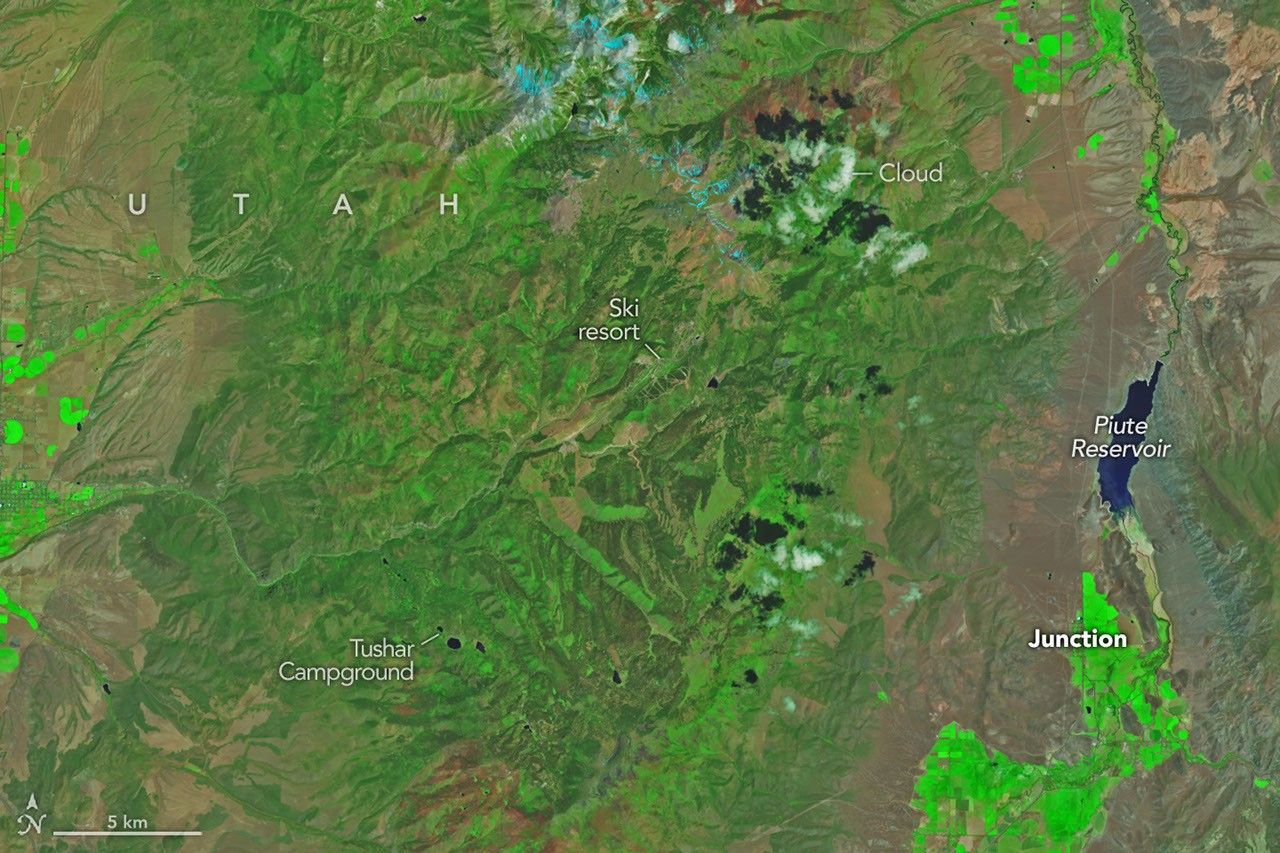
Recent thermal imaging and multispectral data have confirmed a significant ignition event in the Utah sector. According to NASA Breaking News, orbital assets have documented the progression of the Cottonwood Fire, a blaze that has radically altered local topography through rapid combustion of biomass. The incident highlights the persistent vulnerability of arid high-desert biomes to sudden thermal escalation.
Landscape Degradation and Burn Scars
The high-resolution imagery processed by the NASA Earth Observatory indicates a distinct burn scar, a stark infrared signature against the surrounding unburned vegetation. Remote sensing platforms—including the Operational Land Imager (OLI) and other multispectral sensors—are being utilized to quantify the square meterage of the charred region. These sensors detect the shift from chlorophyll-rich reflectance to the carbon-heavy absorption characteristic of post-fire landscapes.
Strategic Implications for Resource Management
This data is not merely for documentation; it provides the logistical backbone for ground-based recovery operations. By analyzing the severity of the burn from low-Earth orbit (LEO), atmospheric scientists and geologists can predict soil erosion risks and potential flash flooding threats caused by the loss of stabilizing root systems.
In an era of intensifying climatic shifts, the synchronization of satellite telemetry and terrestrial response remains the primary defense against large-scale environmental destabilization. The Cottonwood event serves as a critical data point for refining predictive models of fire behavior in the American West, where vegetation mortality and moisture deficits continue to trend toward hazardous levels.