Orbital Analysis: Agricultural Patchwork Observed via Sentinel
New imaging data from the European Space Agency reveals the intricate structural patterns of terrestrial agriculture as seen from low Earth orbit.
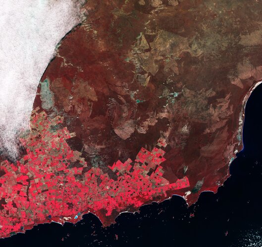
GEO-DATA ACQUISITION
According to ESA, the latest high-resolution imagery captured from the European Copernicus mission provides a stark look at the geometric complexity of human resource management. The agency has released a detailed "Agricultural Patchwork" visualization, showcasing how terrestrial landscapes are partitioned into a mosaic of functional zones. This data, processed via the Sentinel satellite constellation, serves as a critical diagnostic tool for monitoring planetary health and food security.
TECHNICAL OVERVIEW
The visual data highlights the distinctive signatures of various crop cycles and irrigation techniques. In these orbital captures, different vegetation types and soil moisture levels manifest as a spectrum of colors and textures, creating a non-random grid across the Earth's surface. These patterns are not merely aesthetic; they represent the output of highly integrated European space technology working to quantify agricultural yield and environmental impact.
SYSTEM MISSION
ESA’s role as the primary gateway for European space development remains focused on delivering tangible benefits through such Earth Observation (EO) capabilities. By utilizing the Sentinel-2 multispectral instrument, the agency can distinguish between crop species and monitor growth status with high temporal frequency. This mission is essential for ensuring that investment in space-based infrastructure translates into actionable intelligence for citizens and policymakers alike. The data confirms the ongoing necessity of the Copernicus program in maintaining Europe’s strategic autonomy in orbital monitoring and environmental stewardship.