ONTARIO FIRE PLUMES DRIFT EAST: TERRA SATELLITE MONITORS CLOUD SPREAD
New imaging telemetry from NASA reveals massive smoke plumes from Western Ontario's wildfires migrating eastward across the Great Lakes, impacting atmospheric visibility.
ATMOSPHERIC OBSERVATION REPORT
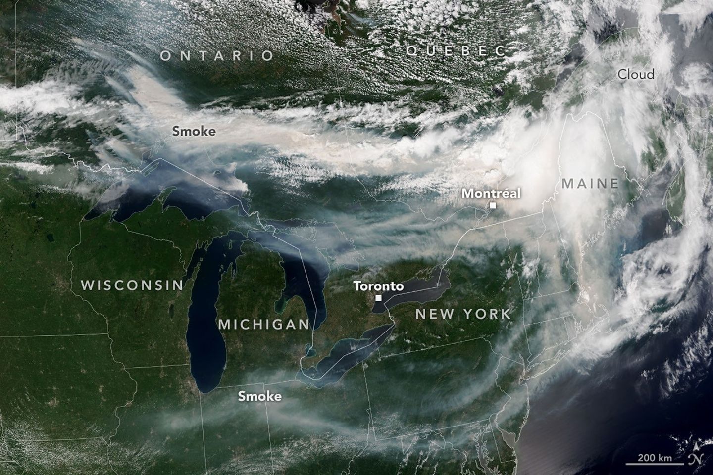
Thermal anomalies and intense combustion events in Northern Ontario have triggered a significant atmospheric event, according to NASA Breaking News. Orbital assets, specifically the Moderate Resolution Imaging Spectroradiometer (MODIS) aboard the Terra satellite, have captured high-resolution telemetry showing dense smoke plumes migrating toward the Atlantic seaboard.
DATA ANALYSIS
The trajectory of the aerosol dispersion follows a persistent eastward vector. Remote sensing data indicates that the smoke originated from a cluster of uncontrolled wildfires in the remote forests of Northern Ontario. Driven by prevailing upper-level wind currents, the haze has breached the boundaries of the Great Lakes region, infiltrating the airspace over portions of the Northeastern United States and Eastern Canada.
SPECTRAL IMPACT
The MODIS sensor, a primary instrument for monitoring Earth's biospheric health, identified the distinctive 'hazy' signature of woodsmoke, which differs from standard cloud formations in its spectral reflectance. Ground-level reports suggest that the influx of Ontario-based particulates is significantly reducing local air quality and altering sky visibility for hundreds of kilometers downstream of the burn sites.
NASA Earth Observatory continues to monitor the situation, utilizing its multi-platform orbital constellation to track the long-range transport of these aerosols as they interact with the North Atlantic circulation patterns.