NOCTURNAL TELEMETRY: HIGH-ORBIT PERSPECTIVES FROM THE ISS
New orbital footage captured from the International Space Station reveals the complex electromagnetic footprint of human civilization across the night side of the Earth.
Orbital Surveillance Data
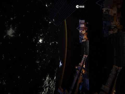
Recent high-definition imaging released via official channels provides a stark visualization of terrestrial infrastructure under low-light conditions. According to ESA YouTube, the vantage point from the International Space Station (ISS) offers a continuous stream of visual data regarding the density and distribution of artificial illumination across the planetary surface.
The Luminescent Footprint
From a mean altitude of 400 kilometers, the distinction between natural geography and technological expansion becomes absolute. The footage highlights the concentration of energy consumption within urban hubs, contrasted sharply by the total darkness of oceanic expanses and underdeveloped terrestrial zones. This is not merely a visual record; it is a map of global power distribution and resource allocation. The ISS, traveling at approximately 28,000 kilometers per hour, crosses sixteen sunsets and sunrises every 24 hours, providing a unique temporal perspective on how European and global cities maintain their operational status throughout the nocturnal cycle.
Operational Implications
Observing Earth at night is fundamental to tracking light pollution and urban sprawl. The European Space Agency utilizes these visual assets to augment atmospheric and meteorological studies. The clarity of the footage confirms the precision of current orbital optics and the stability of the station's observation platforms. For the space industry, these nocturnal captures serve as a reminder of the fragility of the terrestrial grid and the necessity of space-based monitoring to ensure sustainable growth on the ground. The mission continues to prioritize high-resolution documentation of the planetary biosphere to inform future environmental policy.