Mapping De Gerlache-Kocher: Artemis Target Data Finalized
NASA publishes detailed imaging of the De Gerlache-Kocher Massif, a critical high-priority landing zone for the Artemis lunar return program.
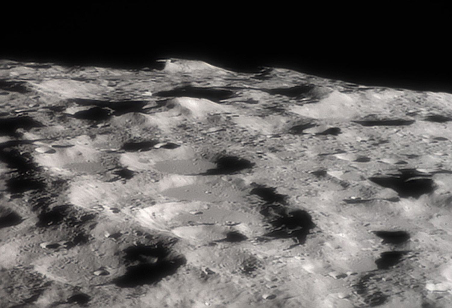
DATA ACQUISITION
According to NASA Breaking News, orbital assets have provided high-resolution telemetry of the De Gerlache-Kocher Massif, a prominent lunar feature situated near the South Pole. This topographic survey serves as a fundamental layer for the Artemis program’s trajectory planning and surface operations.
STRATEGIC RECONNAISSANCE
The Massif is not merely a geological curiosity but a strategic asset. Located in the permanently shadowed regions (PSRs) of the lunar south, the area is hypothesized to contain volatile deposits, specifically water ice. High-altitude peaks in this region offer 'peaks of eternal light,' providing nearly continuous solar power potential, while the adjacent craters remain in total darkness, preserving the ice required for life support and propellant synthesis.
SYSTEM STATUS: MISSION ALIGNMENT
This update coincides with several key mission milestones reported in the November 2026 cycle:
- ESCAPADE: The twin-spacecraft Mars mission is currently executing a gravitational slingshot maneuver past Earth.
- X-70 Fleet: NASA has officially integrated the X-70 experimental aircraft into its atmospheric research wing to advance supersonic flight data.
- Lunar Infrastructure: The refined mapping of De Gerlache-Kocher directly informs the site selection for future Moon Base modules, bridging the gap between orbital observation and surface habitation.
Technicians at SpaceChannel.eu note that the precision of these datasets is vital for autonomous landing systems. As the Artemis roadmap accelerates toward crewed landings, the environmental data from De Gerlache-Kocher represents the most accurate lunar surface model currently available to mission controllers.