Low-Altitude Stratus Overlays Pacific Northwest
A persistent layer of low-altitude stratus clouds has enveloped the Pacific Northwest, providing a stark visual of atmospheric dynamics and coastal topography as observed by NASA’s Earth Observatory.
ATMOSPHERIC OBSERVATION REPORT
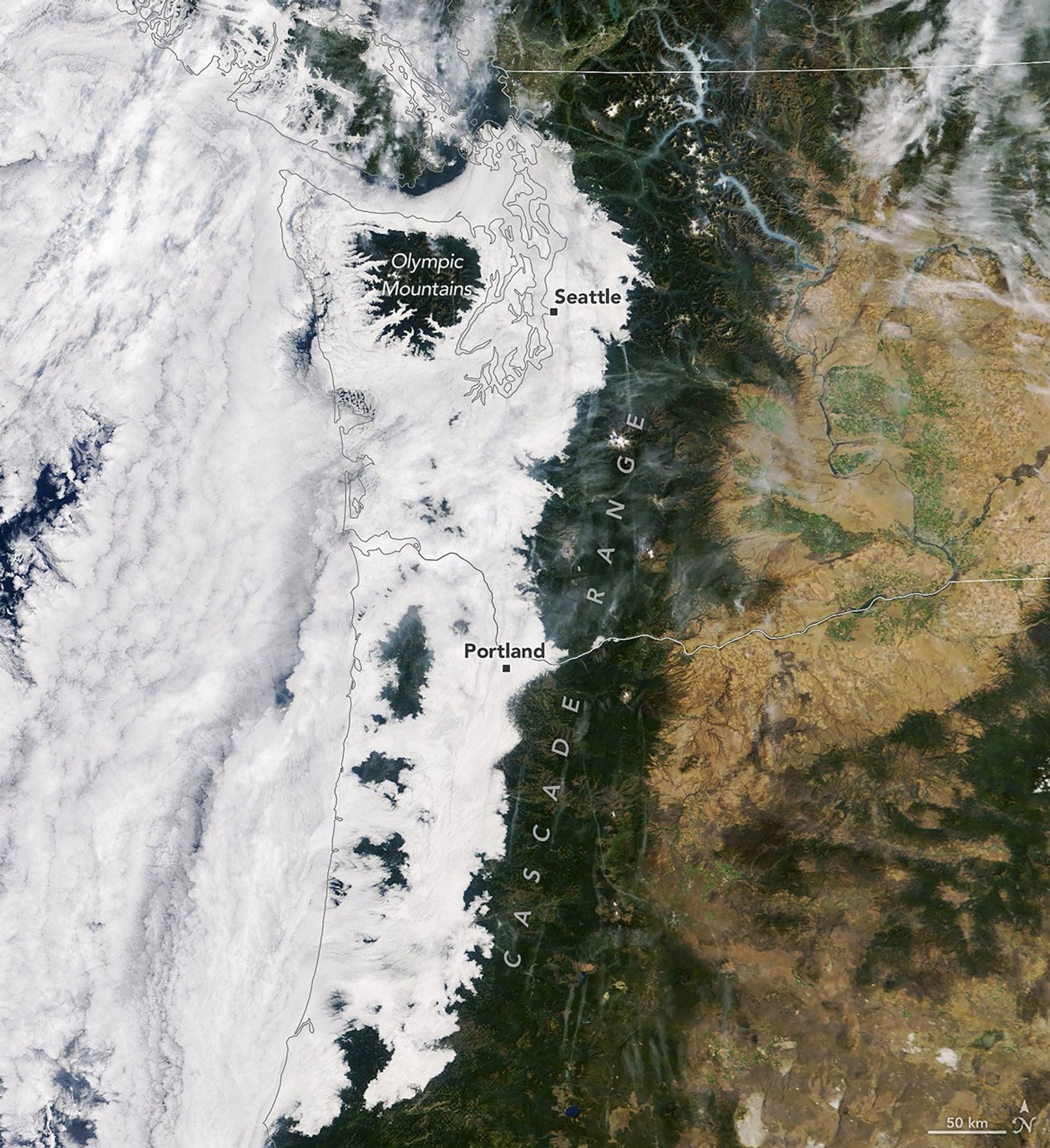
Data streams from NASA’s Earth Observatory have identified a significant meteorological formation currently obstructing terrestrial views across the Pacific Northwest. The phenomenon, described as a dense "cloudy cloak," represents a massive low-altitude stratus formation typical of the region's seasonal atmospheric behavior.
According to NASA Breaking News, the sensor arrays on orbiting assets captured high-resolution imagery showing the white, opaque layer stretching from the coastline into the interior valleys. This specific cloud structure occurs when moist, maritime air is pushed inland and becomes trapped under a stable layer of warmer air, a process known as temperature inversion.
GEO-CLIMATIC IMPACT
For orbital monitoring systems, these formations present both a challenge and a data-rich environment. While the cloud cover obscures direct ground-based optical scans, the precise boundaries of the formation reveal the underlying topography of the Cascades and the coastal ranges. The data suggests that while the higher elevations remained clear, the low-lying urban and agricultural zones were completely submerged under the marine layer.
This incident highlights the ongoing necessity for multi-spectral imaging to bypass atmospheric interference. Such data is critical for assessing regional moisture levels and local thermal variances, ensuring that terrestrial climate models remain accurate despite persistent optical obstructions. The mission logs indicate that these observations are part of a broader mandate to track atmospheric interactions across the North American continent to better understand global weather cycles.