Historical Log: First Surface Imagery of the Martian Frontier
A retrospective on July 20, 1976: the moment NASA’s Viking 1 lander ended the era of speculation by transmitting the first successful imagery from the surface of Mars.
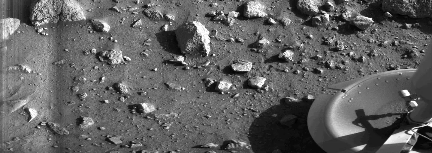
Archive Entry: July 20, 1976
Data retrieval protocols acknowledge a significant milestone in extraterrestrial exploration. According to NASA Breaking News, the Viking 1 lander successfully secured the first-ever close-range visual data from the Martian surface. Following its touchdown on the Chryse Planitia—the 'Plain of Gold'—at 11:53 UTC, the craft deployed its imaging systems to capture the inaugural frame of the red planet's terrain.
Technical Breakdown
The initial image, captured shortly after landing, focused on the spacecraft’s own footpad. This was a tactical decision by mission control to ensure the integrity of the landing gear and to calibrate the instrumentation against known structural components. The secondary transmission provided a panoramic sweep, revealing the desolate, boulder-strewn landscape that would define our visual understanding of Mars for decades.
Mission Context
Launched on August 20, 1975, Viking 1 spent eleven months in transit before reaching the Martian vicinity. After achieving orbit, the lander separated from its carrier, descending through the thin atmosphere to perform the first successful soft landing on Mars. The primary directive was simple but profound: to characterize the Martian environment and search for biosignatures. While the biological results remained inconclusive, the imagery confirmed a world of geological complexity—dust-choked horizons and oxidation-rich soil. This transmission effectively transitioned Mars from a point of light in a telescope to a physical, tangible territory for future human inquiry.