GEO-IMAGING: San Juan River’s Entrenched Meanders
Satellite data reveals the unique geological architecture of Utah’s Goosenecks, where the San Juan River has carved deep, symmetrical loops into the landscape over millions of years.
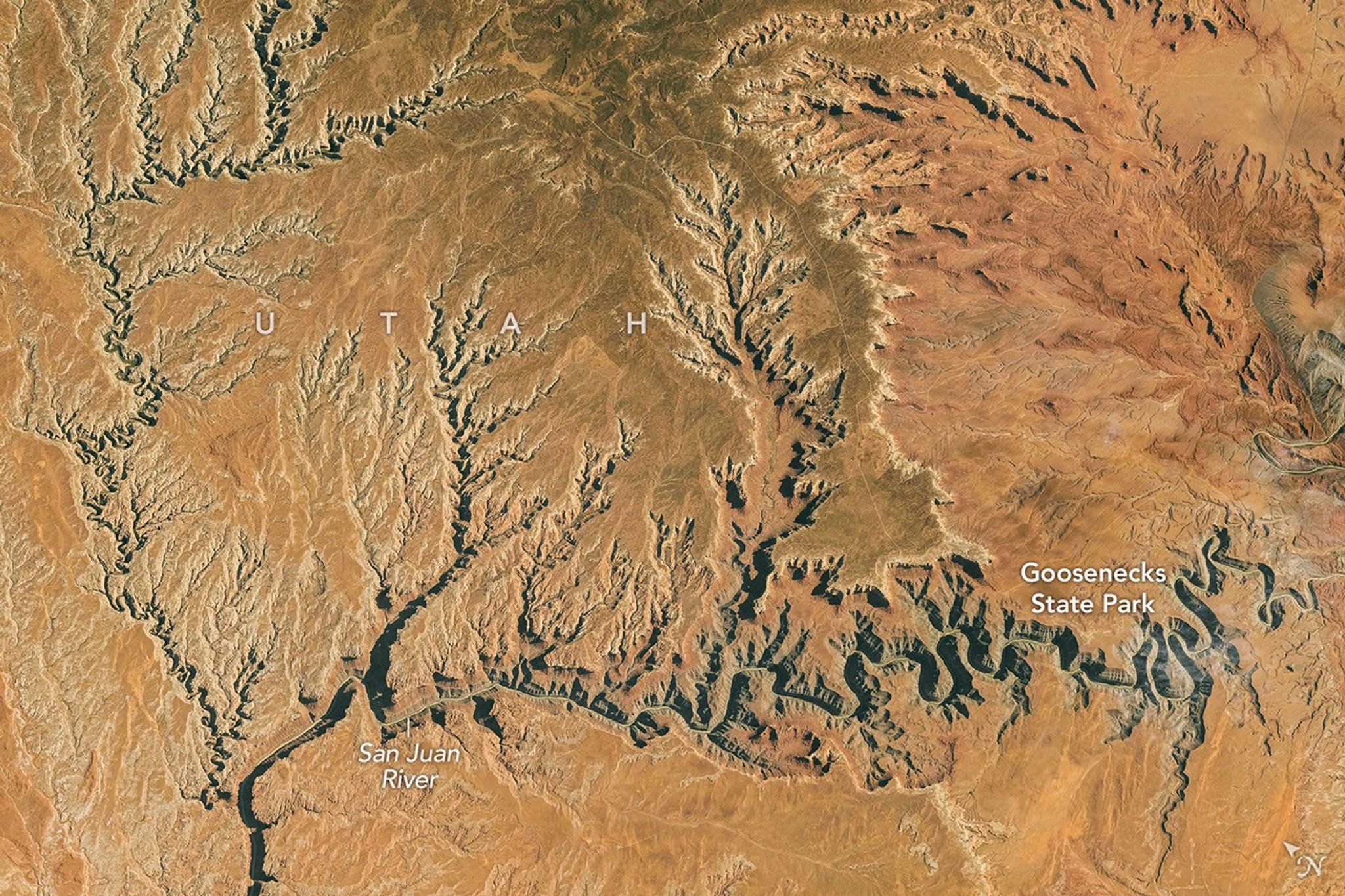
Data Analysis: San Juan River Geomorphology
Recent Earth observation data highlights the striking geological formations within Goosenecks State Park, Utah. According to NASA Breaking News, the San Juan River has engineered a series of "entrenched meanders," carving a path nearly 300 meters deep into the surrounding terrain. While the river travels approximately 8 kilometers through these sharp curves, it advances only 1.5 kilometers in straight-line distance.
Tectonic and Fluvial Interaction
The formation of these loops—popularly termed "goosenecks"—is the result of a rare synchronicity between tectonic uplift and hydraulic erosion. Roughly 300 million years ago, the region served as the floor of a shallow sea, accumulating layers of silt, mud, and marine debris. These deposits eventually lithified into the Halgaito Shale and Honaker Trail limestone formations visible today.
Geological records indicate that as the Colorado Plateau began its gradual ascent millions of years ago, the San Juan River maintained its original, winding course. Rather than shifting its path, the river’s erosive force kept pace with the rising crust, effectively "cutting" its existing pattern into the bedrock. This process creates the symmetrical canyon walls that define the site.
Remote Sensing Observations
Orbital imagery confirms that these meanders are among the most geographically distinct on the planet. Unlike standard floodplain meanders that shift laterally over time, these entrenched features are locked into the vertical architecture of the plateau. For Earth science researchers, the Goosenecks serve as a high-fidelity record of long-term environmental and tectonic stability in the American Southwest.