EarthCARE Profiling: Volcanic Ash Detection Enhanced
New data from the EarthCARE satellite provides high-resolution profiling of volcanic plumes, offering critical data to mitigate aviation risks during eruptive events.
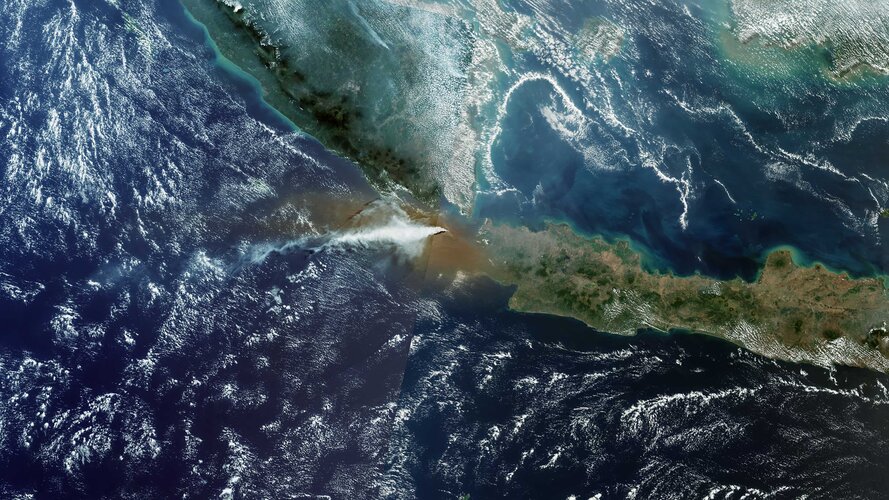
Orbital Surveillance: The Volcanic Factor
According to ESA, the recently launched EarthCARE satellite has successfully demonstrated its capacity to profile volcanic aerosols with unprecedented precision. By utilizing its advanced atmospheric lidar and cloud-profiling radar, the mission is now capable of cutting through atmospheric noise to define the exact vertical structure of volcanic ash clouds.
Critical Data for Aviation Safety
Volcanic eruptions represent a high-stakes variable for European and global airspace. Airborne ash is not merely a visibility issue; it is a mechanical threat, capable of causing catastrophic jet engine failure. Traditional satellite imagery often provides a flat, two-dimensional view of these plumes, which can lead to over-conservative flight cancellations or, conversely, undetected risks.
EarthCARE’s contribution lies in its ability to provide a three-dimensional vertical slice of the atmosphere. By measuring the distribution and density of particles at specific altitudes, the mission allows the Volcanic Ash Advisory Centres (VAACs) to refine their dispersion models. This granular data ensures that flight corridors can remain open where safe, while pinpointing hazardous zones with mathematical certainty.
Instrument Synergy
The mission's success stems from the synchronization of its four primary instruments. While the lidar targets thin aerosols and ash, the radar penetrates thicker cloud layers that might otherwise obscure the plume. This multispectral approach confirms EarthCARE as a primary asset in Europe’s Earth observation fleet, transforming raw atmospheric physics into actionable safety protocols for the aviation industry.