Dual-Stream Analysis: Indigenous Insights Meet Satellite Data to Track Coastal Decay
A NASA project identifies critical coastal erosion by synchronizing orbital observation data with centuries of Indigenous environmental knowledge.
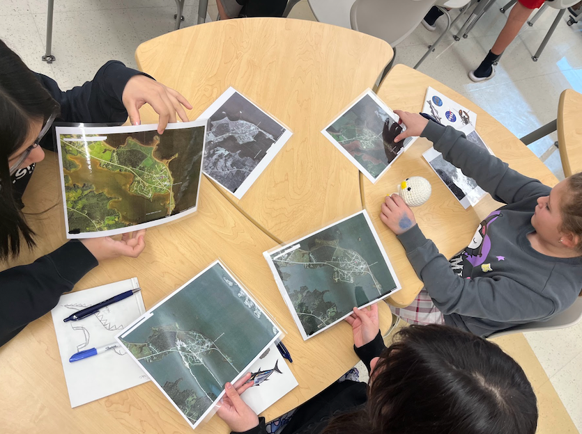
DATA OVERLAY: SHORELINE RECONSTRUCTION
Satellite telemetry is no longer the sole arbiter of planetary monitoring. According to NASA Breaking News, a recent initiative under the agency’s Science Activation program is integrating multispectral orbital data with traditional Indigenous knowledge to quantify the rapid erosion of vulnerable coastlines.
INTEGRATED METHODOLOGY
Students participating in the project are utilizing high-resolution imagery to track physical shifts in landmass. However, the raw data is being cross-referenced with generational environmental records held by local communities. These communities have observed subtle biological and geological changes—such as shifts in vegetation and sediment patterns—that are often missed by automated sensor arrays. By reconciling these historical narratives with contemporary NASA Earth science, researchers can establish a more precise baseline for habitat loss.
SIGNAL VS. NOISE
The synthesis of these two information streams provides a high-fidelity view of climate impact. While satellite sensors offer the macro-view of retreating shorelines, the Indigenous datasets provide the necessary context to understand long-term ecosystem stability. This methodology validates traditional ecological knowledge as a legitimate scientific tool, transforming subjective observation into actionable environmental intelligence.
The findings are intended to assist coastal regions in predicting soil instability and implementing more effective defense strategies against rising sea levels.