Atmospheric Anomaly: Pyrocumulus Formation Captures Pileus Cap
New satellite imagery reveals the intense thermal dynamics of a pyrocumulus cloud, topped by a rare pileus cap, illustrating the powerful intersection of terrestrial heat and atmospheric physics.
Thermal Disturbance Analysis
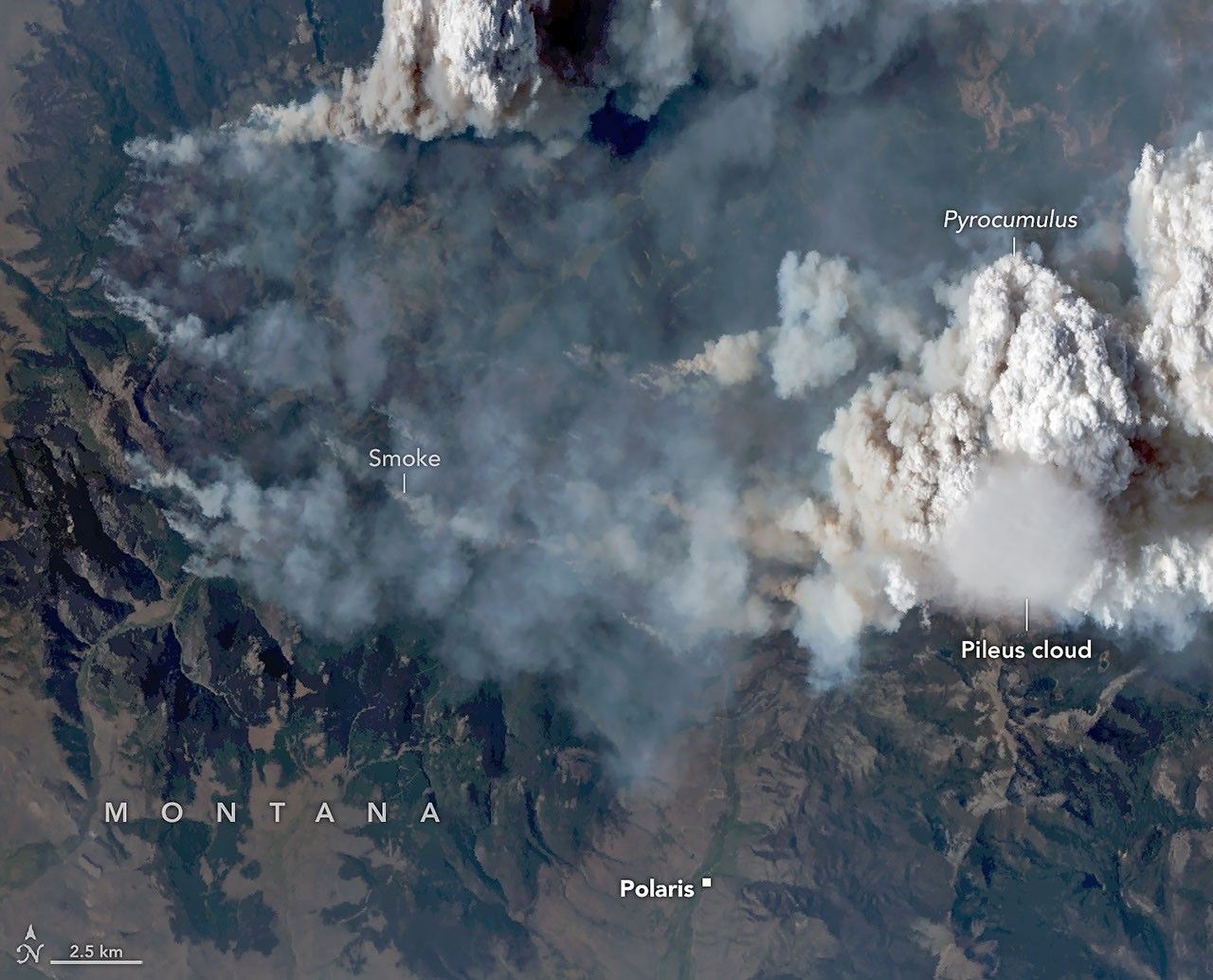
Atmospheric monitoring systems have detected a significant pyrocumulus event, colloquially known as a "fire cloud." According to NASA Breaking News, this phenomenon occurs when extreme surface heat—typically from wildfires or volcanic activity—triggers rapid convection. The intense thermal energy forces air to rise vertically at high velocities, cooling and condensing into massive, soot-heavy clouds.
Pileus Capping
The specific event documented features a pileus, or scarf cloud, situated atop the primary pyrocumulus column. This smooth, horizontal accessory cloud forms when the moisture-rich air of the fire-driven updraft pushes against a stable layer of humid air above it. As the upward column forces this layer to rise, the cooling moisture crystallizes into a distinct, cap-like structure. Unlike the turbulent, darker base of the pyrocumulus, the pileus often appears lighter and more uniform, serving as a visual indicator of rapid vertical growth.
Scientific Implications
Pyrocumulus clouds represent more than just meteorological curiosities; they are significant drivers of atmospheric chemistry. These clouds can inject smoke, ash, and aerosols directly into the stratosphere, where they persist far longer than in the lower atmosphere. By reaching these heights, fire-driven storms influence global weather patterns and solar radiation reflection. The presence of a pileus signifies an especially vigorous updraft, marking an intensification of the heat source on the ground. Data from these observations assist orbital assets in tracking particulate dispersion across continental borders.